ResearchExperience
Design of a Rotating Panoramic Camera System for Imaging Large Deformations of Soft Tissues
University of Pittsburgh, Senior Design Project
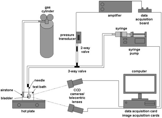
As an essential organ, the bladder serves as a container for the urinary. The tissues of the urinary bladder contract and expands in the process, a healthy bladder is able to expand up to eight times its reserve volume at night. However, bladder compliance decreases significantly with age. Bladder compliance is the amount of liquid the bladder can hold as well as the expansion rate of the bladder. The existing strain analysis uses small samples of tissues removed from a full bladder. However, there is no full-view analysis of the mechanism of the whole bladder to account for heterogeneous or anisotropic properties. The development of panoramic camera systems provides biomedical labs with a convenient way to study the realistic deformation of a bladder in action, giving insight into bladder bio-mechanisms, and further informing the development of grafts and other bladder surgery techniques (Left Figure).
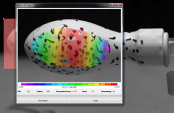
This project focuses on a physical system for a panorama camera system that can image all 360 degrees of the bladder. This system can take photos from two angles, thus allowing 3D strain measurements for only a small portion of the sample upon which the two photos overlapped. Further research on surface strains and pressure in the bladder deformation process contributes to a better understanding of underlying bio-mechanism (Right Figure).


Fighting Wildfires with Machine Learning-Based Mapping Algorithms and Computer Vision Enhancement for Drone Path Planning
University of California, Berkeley, Capstone Project
Facing serious wildfire background in the U.S., especially in high-risk places like California, problems of prediction of wildfire, and the effectiveness of applying drones to wildfire areas, we studied the wildfire background, a market analysis of UAV application using the five forces model, value chain, and built our start-up business model using lean launchpad and other visualizing business methods, like petal diagram. We also collected several stakeholders’ opinions in order to better set up our project’s goal.
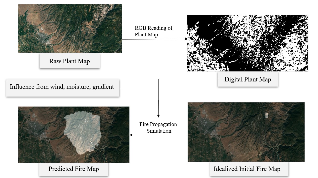
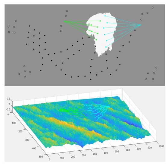
For our technical part, we developed a wildfire detection system and a wildfire evacuation system. These two systems are aimed to accomplish the series goals of early and accurate forecasting, rapid detection, early warning, and early evacuation by wildfire prediction model (Left Figure) and drone path planning model (Right Figure). Specific results and figures prove that our systems will shorten fire stations’ reaction time and improve drones’ efficiency greatly. In the future, we will continue to develop the wildfire forecaster model to finish it and create related applications that can be easily accessible to common people. Also, the UAVs’ path planning algorithm still has the potential to be enhanced in order to achieve even higher efficiency. Meanwhile, more precise geological and weather information can improve the accuracy of wildfire spread prediction.


